

End-to-End Geospatial Solutions
Capture -> Process -> Insights, delivering actionable geospatial intelligence.

System Integration Expertise
Seamless integration of geospatial intelligence for complete, ready-to-deploy solutions.
Deep Tech Expertise
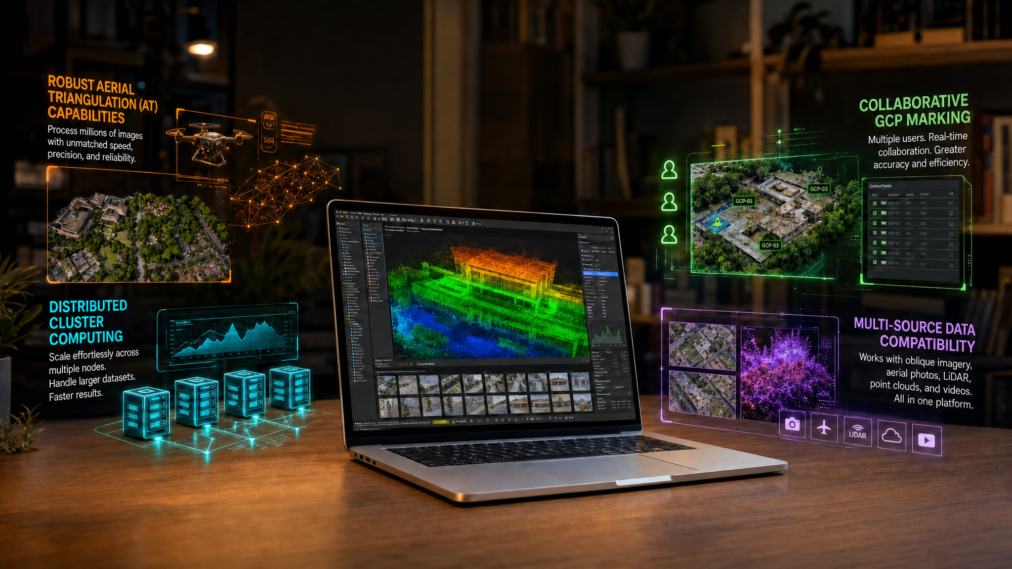
Accelerate surveys, LiDAR processing, and project delivery with optimized workflows.
Scalable Geospatial Workflows
Built for large-scale mapping, high-volume data, and complex geospatial projects.

Strong Technical Partnership
End-to-end support across deployment, training, and execution.

Faster Time-to-Revenue
Convert opportunities into revenue, quickly and efficiently