top of page

LiGrip 02
Flagship Handheld SLAM LiDAR Scanner
LiGrip O2 is the next-generation flagship handheld SLAM LiDAR scanner developed by GreenValley International. This all-in-one device integrates LiDAR, panoramic cameras, visual SLAM cameras, and a GNSS antenna, enabling high-precision, all-directional data acquisition without limitations of time or environment.
Advanced

Weight
1.3kg
Absolute Accuracy
<3cm

120/300 m Maximum Measurement Range
_edited_edited.png)
LiDAR Scan Rate
6,40,0000 pts/s

Panoramic Camera
12 MP ×3

VSLAM Camera
1.3 MP ×2
_edited.png)
Storage Capacity
512 GB SSD

FOV
280° × 360°
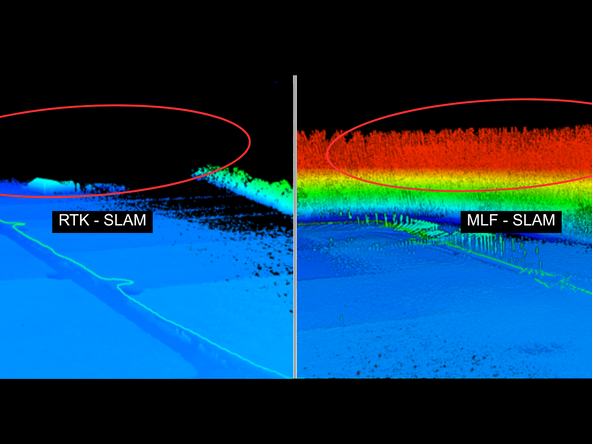
RTK - SLAM vs MLF - SLAM
Designed for open and featureless environments, MLF-SLAM combines multiple localization sources to achieve absolute positioning with centimeter-level accuracy. Whether on highways, beaches, or bridges where GNSS is weak or unavailable, MLF-SLAM ensures stable trajectories, consistent point clouds, and reliable mapping results.
Featureless Data Acquisition
-
Innovatively developed MLF-SLAM algorithm.
-
Effortlessly captures data in weak or featureless environments such as airports, beaches, and water surfaces.


Real-time processing and Colorization, Exportable for use
-
Real-time true-color point cloud mapping, ready for instant export.
-
Support diverse applications like earth calculation, tree segmentation, and topographic mapping.
Precision Data, Outstanding Performance
-
3 cm accuracy with precise horizontal & vertical alignment.
-
Meets surveying-grade standards and streamlines fieldwork.

Multi-form Data Collection
Automatic line intersection identification, autonomous crossing of intersections, real-time tree obstacle reporting and pole/tower log generation, and automated pole/tower identification and photography.
.png)
Backpack Kit
.png)
Frontpack Kit
.png)
Telescopic Pole
Processing Softwares

GreenValley App

LiDAR 360 MLS
(BP Module)

LiDAR 360 MLS
bottom of page


